... Rapa Nui - at the navel of the world ...
|
 |
|||||||||||||||||
|
Rapa Nui, this is what the native people of the Easter Island, who originally immigrated from Polynesia, call their country. Just how lost the tiny island lies surrounded by the seemingly endless expanses of the Pacific Ocean, more than 3500 km west of South America and 4250 km east of Tahiti. The closest inhabited place, Pitcairn Island, is a whopping 2078 km away. This makes Rapa Nui - the Easter Island - the loneliest permanently inhabited place in the world. It is hard to imagine that humans once in tiny reed boats overcame these huge distances and settled the island. Far away from their old homeland, Rapa Nui finally became the center of the earth for its inhabitants - the navel of the world ...
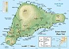
 More than 1000 years later, the journey to the lonely island in the Pacific Ocean is nowhere near as dangerous, but it is still quite impressive. With almost five hours of effective flight time from Peruvian Lima to Hanga Roa, we get a first feeling for the enormous distance that lies between South America and the island. During the landing approach, 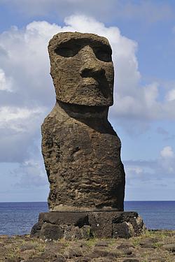 an announcement by the flight captain also illustrates the dangers that can surprise you on this remote island in the vastnesses of the largest of the five oceans: We should prepare for an immediate evacuation, as a tsunami warning for Isla de Páscua (that's the Spanish name of Easter Island) has been issued. Shortly after landing, however, the all-clear was given - the tsunami spared Rapa Nui, but it caused even much worse damage in the Japanese city of Fukushima. That tsunamis on Easter Island are not so rare, an announcement by the flight captain also illustrates the dangers that can surprise you on this remote island in the vastnesses of the largest of the five oceans: We should prepare for an immediate evacuation, as a tsunami warning for Isla de Páscua (that's the Spanish name of Easter Island) has been issued. Shortly after landing, however, the all-clear was given - the tsunami spared Rapa Nui, but it caused even much worse damage in the Japanese city of Fukushima. That tsunamis on Easter Island are not so rare, 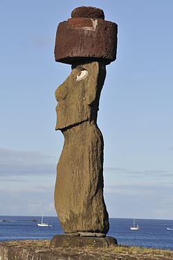 we soon learn during our trips around the island: Many of the mo'ai - the monumental stone statues for which Rapa Nui is world famous - lie broken on the rocky coasts of the island – overturned among other things from tsunamis of the last decades. ... we soon learn during our trips around the island: Many of the mo'ai - the monumental stone statues for which Rapa Nui is world famous - lie broken on the rocky coasts of the island – overturned among other things from tsunamis of the last decades. ...Day 1 (Hanga Roa, Ahu Tahai) The number of accommodations on Rapa Nui (in 2011) is still fairly manageable. As a precaution, we had already contacted Manuel, the operator of the small guesthouse "Chez Joseph" in Hanga Roa, before the start of the trip. He surprises us right at the airport with a very warm welcome and necklaces braided from flowers. On his advice, we buy tickets for the "Rapa Nui National Park" - the main attraction of the island - directly inside the terminal. At Our accommodation, which is actually located in the middle of the island's capital, rather gives the impression of a lonely farmstead. The few bungalows arranged in the carree are surrounded by a well-tended small garden. Flowering bushes and exotic plants take up almost the entire field of view. 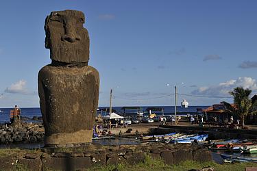 In general, the whole of the town Hanga Roa seems to be more of a sprawling village in a colorful garden landscape than a city. The roads are narrow and partly still unpaved. Two small restaurants, a snack bar, two souvenir shops, a very clear market, a small church and above all the picturesque fishing port with a good dozen of narrow wooden boats in the tiny harbour basin give a idea of where the center of the settlement is located. In general, the whole of the town Hanga Roa seems to be more of a sprawling village in a colorful garden landscape than a city. The roads are narrow and partly still unpaved. Two small restaurants, a snack bar, two souvenir shops, a very clear market, a small church and above all the picturesque fishing port with a good dozen of narrow wooden boats in the tiny harbour basin give a idea of where the center of the settlement is located.A first single standing mo'ai in front of the harbour bay makes our hearts beat faster - yes indeed, we arrived on Easter Island – madness ! The subsequent evening walk to Ahu Tahai - a ceremonial platform with five mo'ai north of Hanga Roa - increases our enthusiasm even further. 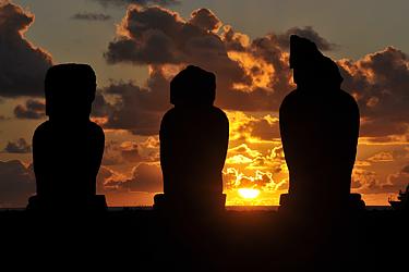 Picturesquely the imposing stone figures stand as black silhouettes in front of the orange-red solar disk sinking into the vastnesses of the Pacific Ocean. Two more platforms, each with a single mo'ai, complete the postcard motif and bestow us a successful start of the tour, which still makes expect great things for the days ahead ! Picturesquely the imposing stone figures stand as black silhouettes in front of the orange-red solar disk sinking into the vastnesses of the Pacific Ocean. Two more platforms, each with a single mo'ai, complete the postcard motif and bestow us a successful start of the tour, which still makes expect great things for the days ahead !Day 2 (Ahu Tahai, West coast, Ahu Akivi) With an east-west extension of around 24 km and a north-south extension of a maximum of 13 km, Easter Island is not really big, but the distances are definitely too far to explore all the sights on foot. Asked about the local transport options, Manuel takes us to a car rental company the next morning, which offers small off-road vehicles of the Suzuki Jimny brand surprisingly cheap 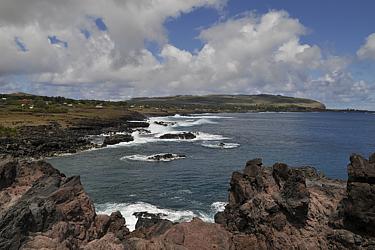 (for (for Well motorized, we start our day tour at Ahu Tahai, the ceremonial site not far from the island metropolis, which we already knew from the previous evening. The group of figures stands in the most glorious morning light; behind it, in the wide blue of the ocean, an approaching cruise ship - it looks like we're getting company. (Amazingly, we haven't seen a single other tourist on the island yet - that's probably going to change now ...) But for now, the terrain still belongs to us alone. 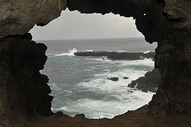 In our fire-red vehicle we follow the lonely, rather bumpy track along the west coast, make short stops at other stone figures, marvel at the mighty surf on the black, steeply sloping cliffs, explore ancient cave dwellings and grope our way through a dark lava tube that leads to two natural windows in the middle of the high cliffs. (Unfortunately, our flashlights are in the accommodation, but, as it turns out, the weak auxiliary lights of the cameras are sufficient if necessary - which ultimately gives the unplanned cave excursions even a particularly adventurous kick.) The land all around is barren and stony and, apart from thin gray-green tufts of grass, completely bare. Here, far from the colorful Hanga Roa, you can experience the sad result of centuries of overexploitation of nature up close. In our fire-red vehicle we follow the lonely, rather bumpy track along the west coast, make short stops at other stone figures, marvel at the mighty surf on the black, steeply sloping cliffs, explore ancient cave dwellings and grope our way through a dark lava tube that leads to two natural windows in the middle of the high cliffs. (Unfortunately, our flashlights are in the accommodation, but, as it turns out, the weak auxiliary lights of the cameras are sufficient if necessary - which ultimately gives the unplanned cave excursions even a particularly adventurous kick.) The land all around is barren and stony and, apart from thin gray-green tufts of grass, completely bare. Here, far from the colorful Hanga Roa, you can experience the sad result of centuries of overexploitation of nature up close. 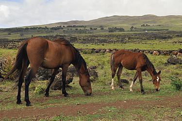 To our astonishment, horses graze in many places which appear free and feral and which fill the otherwise rather dreary, volcanism-formed landscape with life. To our astonishment, horses graze in many places which appear free and feral and which fill the otherwise rather dreary, volcanism-formed landscape with life.The afternoon is well already advanced when we reach Ahu Akivi - the only remaining ceremonial platform away from the coastline. The sight is magnificent: Seven well-preserved stone colossuses look out from a cleanly restored ramp to the distant west coast. Horses graze in front of the stone giants, a stone's throw behind the lush green of a eucalyptus grove offers the eye a welcome contrast to the arid grassland. The constantly blowing wind conjures idiosyncratic white-gray cloud formations on the otherwise azure blue sky and soon tears them apart again. 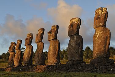 The light of the setting sun completes the play of colors, gradually transforming the gray of the tuff stone figures into a golden yellow and finally into a bronze-colored tone. We wait until dusk banishes the afterglow and then we drive back to Hanga Roa. The cruise ship has long since departed and the place lies, idyllically as the day before, under a wonderful southern starry sky. The light of the setting sun completes the play of colors, gradually transforming the gray of the tuff stone figures into a golden yellow and finally into a bronze-colored tone. We wait until dusk banishes the afterglow and then we drive back to Hanga Roa. The cruise ship has long since departed and the place lies, idyllically as the day before, under a wonderful southern starry sky.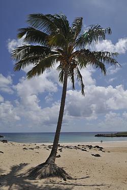 This day shall belong above all to our little daughter Eloisa: We want to go to the beach with her. But just a look at the map shows that this is not that easy on Rapa Nui. But just a look at the map shows that this is not really easy on Rapa Nui. The island is volcanic - and although the last volcanoes were extinguished thousands of years ago, they still determine the appearance of the landscape today. The base of Easter Island resembles a triangle with a volcanic cone in each corner. Erosion has rounded and flattened the cones and turned large parts of the island into rocky hill country, but the coasts are rocky and rough. The mighty waves of the Pacific break steadily against rugged basalt cliffs and stony banks. Only in the north - at the other end of the island as seen from Hanga Roa - there is a small sheltered bay with a sandy beach: the Anakena Bay. Exactly where, according to a legend, the forefathers of the Rapanui-Maori once set foot on the island, it shall go today. Thanks to our red off-road racer, this shouldn't be a big problem either, but first we urgently need to go once again to Hanga Roa airport. This day shall belong above all to our little daughter Eloisa: We want to go to the beach with her. But just a look at the map shows that this is not that easy on Rapa Nui. But just a look at the map shows that this is not really easy on Rapa Nui. The island is volcanic - and although the last volcanoes were extinguished thousands of years ago, they still determine the appearance of the landscape today. The base of Easter Island resembles a triangle with a volcanic cone in each corner. Erosion has rounded and flattened the cones and turned large parts of the island into rocky hill country, but the coasts are rocky and rough. The mighty waves of the Pacific break steadily against rugged basalt cliffs and stony banks. Only in the north - at the other end of the island as seen from Hanga Roa - there is a small sheltered bay with a sandy beach: the Anakena Bay. Exactly where, according to a legend, the forefathers of the Rapanui-Maori once set foot on the island, it shall go today. Thanks to our red off-road racer, this shouldn't be a big problem either, but first we urgently need to go once again to Hanga Roa airport. 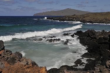 (A significant part of our luggage had been lost on the flight here. According to a message from the airline, the missing parts are now said to have arrived on Easter Island this morning. So let's hope for the best !) (A significant part of our luggage had been lost on the flight here. According to a message from the airline, the missing parts are now said to have arrived on Easter Island this morning. So let's hope for the best !)The "Mataveri International Airport" south of Hanga Roa is small but fine. Mo'ai, sculptures of the Birdman cult, palm trees and flower beds line the runway built by NASA as an emergency landing site for the Space Shuttle project, which ends in front of a stylish, flat reception building. On the parking position there is a extraordinary painted airplane with the inscription "Edelweiss" - a strange sight in this environment and a circumstance that should soon give us a very special experience. But for the time being, we suspect nothing of that. Fortunately, the missing parts of our luggage have actually arrived completely. 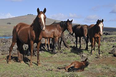 So nothing should stand in the way of the further course of our journey. So nothing should stand in the way of the further course of our journey.Relieved, we start our excursion to the north coast of the island. A narrow, well-paved road passes Hanga Roa and leads across an area reforested with eucalyptus in the centre of the island. Halfway a stony slope branches off towards Maunga Terevaka, the highest mountain on the island at 507 m. Curtly we decide to take a little detour. In sections it goes steeply uphill - so steep that I have to push our "Jimny" hard to its limit. Soon the wooded slope lies behind us and the view opens over large parts of the island. Hilly grassland extends to the eastern tip of Easter Island where the shield-shaped volcano Maunga Puakatiki rises. To the southeast we see the smaller crater of the Rano Raraku 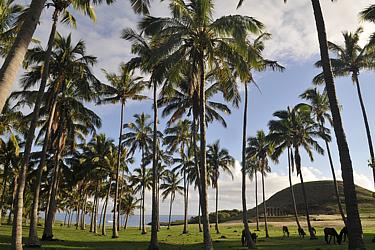 and the conical tip of the Maunga Te Kahu Rere, in the southwest the Rano Kau can be seen and all around the sea glistens in the sunlight. and the conical tip of the Maunga Te Kahu Rere, in the southwest the Rano Kau can be seen and all around the sea glistens in the sunlight.Back on the tar road, it's only a short drive to Anakena. Just before the bay, the route bends sharply eastwards. We park the car and follow a path through a bright palm grove, which in itself is very remarkable, as palm trees are a real rarity on Easter Island and otherwise only scattered grow in the gardens of Hanga Roa. In the shadow of the towering trunks, horses romp around, 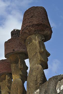 behind it we can already see the light yellow sand of the beach of Anakena. The sandy bay is heavenly beautiful and invites to swim, but a ceremonial platform built between palm trees and the beach - the Ahu Nau Nau with its seven imposing mo'ai - first of all attracts us as magically. Five of the seven stone figures standing on the ramp are fantastically well preserved. Four of them still wear the large hats made of dark red tuff stone, which once probably adorned the heads of most of the local mo'ai. Undoubtedly, this is the best-preserved cult platform we've seen on Rapa Nui so far. n the vicinity there are further fallen stone figures on the sandy ground and from a nearby hill a another single standing mo'ai watches over the bay and the palm grove. Unfortunately, the sun is already much too high in the north (we are in the southern hemisphere !) and thus it is therefore behind the mo'ai who are looking to the south. For better photos we apparently have to come back here once again - and as early as possible in the morning. behind it we can already see the light yellow sand of the beach of Anakena. The sandy bay is heavenly beautiful and invites to swim, but a ceremonial platform built between palm trees and the beach - the Ahu Nau Nau with its seven imposing mo'ai - first of all attracts us as magically. Five of the seven stone figures standing on the ramp are fantastically well preserved. Four of them still wear the large hats made of dark red tuff stone, which once probably adorned the heads of most of the local mo'ai. Undoubtedly, this is the best-preserved cult platform we've seen on Rapa Nui so far. n the vicinity there are further fallen stone figures on the sandy ground and from a nearby hill a another single standing mo'ai watches over the bay and the palm grove. Unfortunately, the sun is already much too high in the north (we are in the southern hemisphere !) and thus it is therefore behind the mo'ai who are looking to the south. For better photos we apparently have to come back here once again - and as early as possible in the morning. The beach is paradisiacal and amazingly only visited by very few people. We look for a place in the shadow of two palm trees, build sandcastles with Eloisa and splash around with her in the shallow warm water of the bay. Soon some local children join us with improvised surfboards. Eloisa immediately seizes one of the boards. The boys, who are probably twice as old, let them grant and amuse themselves magnificently about the caprioles that our little one makes with it. The beach is paradisiacal and amazingly only visited by very few people. We look for a place in the shadow of two palm trees, build sandcastles with Eloisa and splash around with her in the shallow warm water of the bay. Soon some local children join us with improvised surfboards. Eloisa immediately seizes one of the boards. The boys, who are probably twice as old, let them grant and amuse themselves magnificently about the caprioles that our little one makes with it.In the afternoon a bus brings a good dozen noisy tourists - easy for us to recognize as Germans. 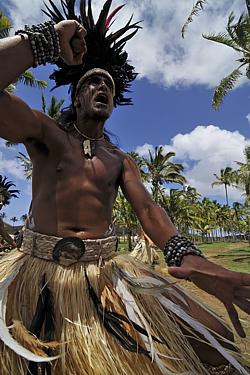 At first we are not very enthusiastic about the sudden company of our compatriots, but soon we come into conversation and learn that they are travelers around the world who only made a short stopover with her airplane on the island. So that explains the strange plane at the airport. A short time later, a second minibus arrives. Almost as many locals emerge from it - all dressed in the colorful traditional robes of the native Polynesian people - which means, apart from loincloths and headdresses made of raffia, feathers or flowers, almost naked - and equipped with all kinds of musical instruments. Immediately the newcomers begin to play and dance - the young women very graceful, the muscular men with grim looks and the martial gestures that are so characteristic of the "Hoko" called ritual war dances of the Rapanui-Maori. We are thrilled and completely surprised. Our globetrotters, on the other hand, are far less surprised, as this is the organized cultural program of their stopover on Easter Island - what a stroke of luck for us ! At first we are not very enthusiastic about the sudden company of our compatriots, but soon we come into conversation and learn that they are travelers around the world who only made a short stopover with her airplane on the island. So that explains the strange plane at the airport. A short time later, a second minibus arrives. Almost as many locals emerge from it - all dressed in the colorful traditional robes of the native Polynesian people - which means, apart from loincloths and headdresses made of raffia, feathers or flowers, almost naked - and equipped with all kinds of musical instruments. Immediately the newcomers begin to play and dance - the young women very graceful, the muscular men with grim looks and the martial gestures that are so characteristic of the "Hoko" called ritual war dances of the Rapanui-Maori. We are thrilled and completely surprised. Our globetrotters, on the other hand, are far less surprised, as this is the organized cultural program of their stopover on Easter Island - what a stroke of luck for us ! 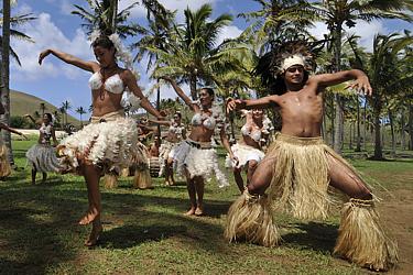 The Rapanui rock the beach for well over an hour. The rhythm of the instruments goes straight into the blood and soon we are asked to dance too ... The Rapanui rock the beach for well over an hour. The rhythm of the instruments goes straight into the blood and soon we are asked to dance too ...For the way back to Hanga Roa we choose the coastal route. The road initially follows close to the rocky north coast and leads directly to the shield-shaped volcanic Maunga Puakatiki on the Poike peninsula. Several times we pass the sad remains of destroyed mo'ai. A signposted area with prehistoric rock carvings invites to a short stopover. Immediately in front of Maunga Puakatiki, which dominates the entire eastern tip of Easter Island, the route bends southwards, precisely towards the bay of Hutuiti. 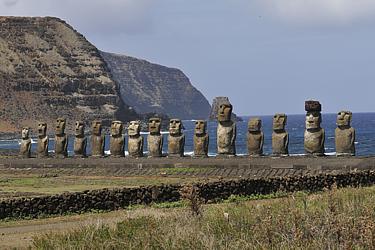 Who would have thought that today, after everything we have already seen and experienced that day, anything could make us to be beside oneself with amaze ? We ourselves at least not - until the Ahu Tongariki suddenly appears in front of us ... 15 stone giants lined up on an almost 150 m long platform, behind which the mighty waves of the Pacific Ocean crashing against the steep coast of Poike. Terrific ! A semicircular natural stone wall frames the entire area spaciously, in which rock carvings and petroglyphs can also be found. A single mo'ai flanks the entrance like a silent guardian of the complex. Here too - as almost everywhere on the island - the mo'ai stand with their backs to the coast, so they look inland - to the crater of the volcano Rano Raraku, which towers west of us, behind which the sun is slowly setting. Although the facility is currently in the best light from a photographic point of view, we are once again the only visitors for miles around. Strange, are there really so few tourists on Easter Island ? Well - of course that's nice for us. Only when the long shadow of the Rano Raraku completely covers the impressive cult site, we can evade its magic. It is high time to go back to Hanga Roa and put Eloisa into bed ... Who would have thought that today, after everything we have already seen and experienced that day, anything could make us to be beside oneself with amaze ? We ourselves at least not - until the Ahu Tongariki suddenly appears in front of us ... 15 stone giants lined up on an almost 150 m long platform, behind which the mighty waves of the Pacific Ocean crashing against the steep coast of Poike. Terrific ! A semicircular natural stone wall frames the entire area spaciously, in which rock carvings and petroglyphs can also be found. A single mo'ai flanks the entrance like a silent guardian of the complex. Here too - as almost everywhere on the island - the mo'ai stand with their backs to the coast, so they look inland - to the crater of the volcano Rano Raraku, which towers west of us, behind which the sun is slowly setting. Although the facility is currently in the best light from a photographic point of view, we are once again the only visitors for miles around. Strange, are there really so few tourists on Easter Island ? Well - of course that's nice for us. Only when the long shadow of the Rano Raraku completely covers the impressive cult site, we can evade its magic. It is high time to go back to Hanga Roa and put Eloisa into bed ...
Day 4 (Ahu Nau Nau, South coast, Ahu Tongariki) Driven by the hope of being able to photograph the Ahu Nau Nau, the impressive sanctuary in the picturesque Anakena Bay, in the light of the morning sun better than yesterday, we set off long before sunrise and head north. Far too early we reach the bay: Although the suns are rising straight up, a hill east of the complex casts its shadow on the ramp with the mo'ai for a long time. We use the time for a morning swim in the bay, which is still deserted at this time. 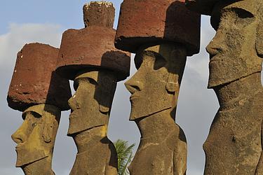 Then finally our patience is rewarded and for a short time the stone figures with their red hats stand wonderfully in the sunlight ... Then finally our patience is rewarded and for a short time the stone figures with their red hats stand wonderfully in the sunlight ...Very satisfied with the pictures we took, we soon drive back to Hanga Roa, where a small but delicious breakfast is already waiting for us in the dining room of our guesthouse. Well strengthened, we finally set off on our actual day tour, which today is primarily intended to bring us closer to the southern coastal region. We start at the airport. Just a stone's throw from the eastern end of the runway, we come across the first mo'ai - more precisely, their sad remains. The shore here is flat and stony. Severally or in whole groups, the heavy bodies of the enormous cult figures lie in exposed places in the rubble of the rugged coastline.  Many of them are burst, others are still surprisingly well preserved, and others can hardly be recognized as sculptures. Most of the time we first discover the giant red hats that are scattered far around these debris fields and that catch the eye between the light gray rocks on the shore. Nearly a dozen of such mo'ai cemeteries we count on our way along the south coast. Once the Ahu - the ceremonial platforms of the Rapanui Maori - must have stood here very close together. But what has destroyed them all ? Was it the forces of nature - or were the figures overthrown by the islanders themselves ? Many of them are burst, others are still surprisingly well preserved, and others can hardly be recognized as sculptures. Most of the time we first discover the giant red hats that are scattered far around these debris fields and that catch the eye between the light gray rocks on the shore. Nearly a dozen of such mo'ai cemeteries we count on our way along the south coast. Once the Ahu - the ceremonial platforms of the Rapanui Maori - must have stood here very close together. But what has destroyed them all ? Was it the forces of nature - or were the figures overthrown by the islanders themselves ?In fact, frighteningly little is known about the history of Easter Island and the Rapanui-Maori living here. It is believed that the first people of Polynesian descent reached the island in the 5th or 6th centuries. 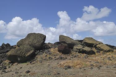 In the beginning, only the coastal areas were probably settled. Around the 11th century, the construction of the ceremonial platforms with the mo'ai, which presumably served the cultic ancestor worship, most likely began. (At the heyday of the Rapanui culture in the late 16th century, there must have been more than 250 ahus with over 1000 mo'ai.) As a result of rapid population growth, the interior of the island was presumably settled from the 13th century onwards and a veritable overexploitation of natural resources began. The island has been completely deforested and many animal species have been exterminated. The resulting shortage of raw materials and increasing famine must have led to numerous tribal wars and even cannibalism from the 17th century. In the beginning, only the coastal areas were probably settled. Around the 11th century, the construction of the ceremonial platforms with the mo'ai, which presumably served the cultic ancestor worship, most likely began. (At the heyday of the Rapanui culture in the late 16th century, there must have been more than 250 ahus with over 1000 mo'ai.) As a result of rapid population growth, the interior of the island was presumably settled from the 13th century onwards and a veritable overexploitation of natural resources began. The island has been completely deforested and many animal species have been exterminated. The resulting shortage of raw materials and increasing famine must have led to numerous tribal wars and even cannibalism from the 17th century. 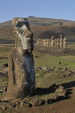 A new rite - the Birdman cult - at that time supplanted the ancestral worship associated with the mo'ai and probably triggered the destruction of most of the traditional ceremonial sites. Natural disasters and tsunamis then did the rest. When the first European set foot on the island on Easter Sunday 1722, the culture of the Rapanui-Maori was already in ruins. A new rite - the Birdman cult - at that time supplanted the ancestral worship associated with the mo'ai and probably triggered the destruction of most of the traditional ceremonial sites. Natural disasters and tsunamis then did the rest. When the first European set foot on the island on Easter Sunday 1722, the culture of the Rapanui-Maori was already in ruins.Not spared from the devastation, but neatly rebuilt, the imposing Ahu Tongariki marks the eastern end of the flat, walkable part of the south coast and thus also the end point of our today's day tour. But before we pay our respects to the 15 mo'ai a second time, we wanna take a quick look at our tomorrow's destination, the Rano Raraku. The sun is still high enough in the sky and the way to the foot of the striking volcano is not too far. As it soon becomes apparent, the area around the steeply towering crater wall is fenced spaciously. For admission we need a ticket of the "National Park Rapa Nui". 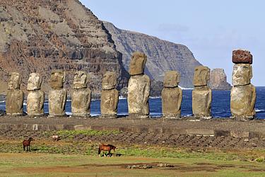 We do have our tickets we bought when we arrived at the airport quite with us, but - as we are told at the entrance - these are only valid for a single visit to the facility - and we'd rather save it for tomorrow. Nevertheless, already from a distance we can see some things that really fuel our curiosity about the mountain. We do have our tickets we bought when we arrived at the airport quite with us, but - as we are told at the entrance - these are only valid for a single visit to the facility - and we'd rather save it for tomorrow. Nevertheless, already from a distance we can see some things that really fuel our curiosity about the mountain.The narrow gravel road, which leads from Rano Raraku across the flat grass and bushland in front of the volcanic cone to the Ahu Tongariki, gives us a strange sight: 15 stone heads that seem to float over the scrub. Just briefly before we reach the large ceremonial complex, the view of the entire complex opens up. Even today, the area lies lonely and abandoned in the landscape. Only a few horses are grazing in front of the long stone ramp. 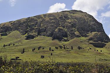 Just like yesterday, we first take a lap around the platform and then we look for a nice place to enjoy the sunset. Just like yesterday, we first take a lap around the platform and then we look for a nice place to enjoy the sunset.The evening we spend with Manuel, the manager of "Chez Joseph". Yesterday we told him about our experiences on the beach of Anakena, whereupon he now delights us with a sizable collection of recordings of local musicians. With spirited music and a few drinks, the evening will be quite long ! Day 5 (Rano Raraku) Fabulous 397 mo'ai adorn the slopes of Rano Raraku - most of them around the south-western outer wall, but some also inside the volcanic crater. 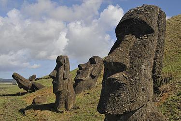 Undoubtedly, the "Volcano of Sculptors" (so the approximate translation of the name) is the main attraction of Easter Island, which is really not poor in sightseeing. - It's always a good idea to save the best for last, but now we just can't resist any longer and dedicate our fifth day on Rapa Nui fully to the fiery mountain of the mo'ai. The weather is kind to us again today: The sky is bright blue, spotted with some photogenic white clouds. At the ticket booth in front of the entrance to the national park, we let validate our tickets and full of excitement we enter the footpath to the southern slope of the volcano. Undoubtedly, the "Volcano of Sculptors" (so the approximate translation of the name) is the main attraction of Easter Island, which is really not poor in sightseeing. - It's always a good idea to save the best for last, but now we just can't resist any longer and dedicate our fifth day on Rapa Nui fully to the fiery mountain of the mo'ai. The weather is kind to us again today: The sky is bright blue, spotted with some photogenic white clouds. At the ticket booth in front of the entrance to the national park, we let validate our tickets and full of excitement we enter the footpath to the southern slope of the volcano.Dozens of large grey-brown mo'ai populate the grassy slope in the lower third of the mountain. 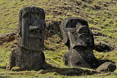 Some are standing, others are lying, still others are grotesquely inclined, as if they had suddenly changed their minds after falling. There are mo'ai that can be admired almost completely (that means from the belly button upwards), others are buried up to the shoulder area and with some of the stone figures only the mighty head looks out of the earth - a truly bizarre sight and a wealth of great photo motifs. The path winds up the mountainside to the old quarries directly on the steep slope of the volcano. Some are standing, others are lying, still others are grotesquely inclined, as if they had suddenly changed their minds after falling. There are mo'ai that can be admired almost completely (that means from the belly button upwards), others are buried up to the shoulder area and with some of the stone figures only the mighty head looks out of the earth - a truly bizarre sight and a wealth of great photo motifs. The path winds up the mountainside to the old quarries directly on the steep slope of the volcano.Once the Rano Raraku was the place where the mo'ai were created. Almost all of the large stone sculptures of Easter Island were created here on the tuff stone slopes of the extinguished mountain of fire. The former quarries are still recognizable today. 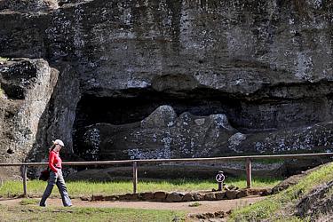 One of them in particular catches the eye - a niche carved deep into the rock, in which the torso of a huge but unfinished mo'ai rests, still firmly attached to the rock. Abruptly, the break of the islanders with their ancestral cult practiced over centuries must have taken place - how else could it be explained that such an elaborate work as this half-finished giant was suddenly given up ? One of them in particular catches the eye - a niche carved deep into the rock, in which the torso of a huge but unfinished mo'ai rests, still firmly attached to the rock. Abruptly, the break of the islanders with their ancestral cult practiced over centuries must have taken place - how else could it be explained that such an elaborate work as this half-finished giant was suddenly given up ?The further we follow the path leading eastwards over the stony slope of the Rano Raraku, the more impressive the view over the southeastern coastal region becomes. Here, a little away from the other sculptures, we also come across a really unusual stone figure: A kneeling mo'ai with a round head and a hinted beard. The sculpture called "Tukuturi" is the only mo'ai with legs and a far less stylized, clearly more human posture.  From its location there is a particularly beautiful view of the Ahu Tongariki, located just off the coast, and the cliffs of the Poike peninsula towering behind. From its location there is a particularly beautiful view of the Ahu Tongariki, located just off the coast, and the cliffs of the Poike peninsula towering behind.High and steeply the ring wall of the Rano Raraku rises here on the southern side. To get inside the volcano, we have to go back to the west-facing flank. A narrow path leads up there to a notch in the western flank of the tuff stone cone. The ascent is not too steep, but with each step we swirl up clouds of fine ocher-colored dust. Intense orange-yellow also shines the soft rock, which flanks the access to the caldera. From the apex of the wall we overlook the entire volcanic crater in its rather impressive extent for the first time. The most striking eye-catching is a lake surrounded by reed grass, takes up a large part of the volcanic basin. Behind it, in the southeast of the caldera, the ring wall reaches its maximum height. 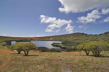 Right there, from a distance, as small as gray dots, we can see all the mo'ai that were once set up inside the Rano Rarakus. We follow the winding path past flowering shrubs down to the shore of the lake. Some horses that romp in the shallow water give me an idea: It's warm, we're sweaty and there's nowhere else to see a human - what could be more obvious than a short dip in the lake ? No sooner said than done - but the shore is muddy. The way into the water leads through reeds and knee-deep morass - and soon I regret my decision ... Right there, from a distance, as small as gray dots, we can see all the mo'ai that were once set up inside the Rano Rarakus. We follow the winding path past flowering shrubs down to the shore of the lake. Some horses that romp in the shallow water give me an idea: It's warm, we're sweaty and there's nowhere else to see a human - what could be more obvious than a short dip in the lake ? No sooner said than done - but the shore is muddy. The way into the water leads through reeds and knee-deep morass - and soon I regret my decision ...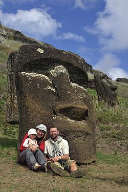 Dried by the sun, the mud soon crumbles off me again - and at least a little refreshed it can finally go on. Gradually climbing the other side of the crater, we first come across a fresh excavation site. Around two of the colossal stone figures, the floor neatly was removed here not so long ago. The still clearly visible discoloration of the rock reveals that both giants were recently hidden up to the tips of their noses in the moist soil. A little further on, further sculptures stand and lie - and in fact, some of them only look out of the grassy ground with their nose, eyes and forehead. Most of the mo'ai, all facing the crater lake, stand on the slightly steeper south slope. It's only a few dozen meters from here to the highest point of the crater wall. We finally climb the summit via a cascade of larger and smaller boulders. Dried by the sun, the mud soon crumbles off me again - and at least a little refreshed it can finally go on. Gradually climbing the other side of the crater, we first come across a fresh excavation site. Around two of the colossal stone figures, the floor neatly was removed here not so long ago. The still clearly visible discoloration of the rock reveals that both giants were recently hidden up to the tips of their noses in the moist soil. A little further on, further sculptures stand and lie - and in fact, some of them only look out of the grassy ground with their nose, eyes and forehead. Most of the mo'ai, all facing the crater lake, stand on the slightly steeper south slope. It's only a few dozen meters from here to the highest point of the crater wall. We finally climb the summit via a cascade of larger and smaller boulders.  A magnificent panorama rewards the short climbing. Steep, almost vertically, the outer wall of the crater abruptly drops southeastwards. Deep below us, the plain extends to the southern coast, where the 15 mo'ai of Tongariki watch over Easter Island. Further to the east, the shield volcano Maunga Puakatiki completely occupies the Poike peninsula, to the north the Rano Raraku crater basin opens and far to the west the Rano Kau marks the beyond side end of this small world. A magnificent panorama rewards the short climbing. Steep, almost vertically, the outer wall of the crater abruptly drops southeastwards. Deep below us, the plain extends to the southern coast, where the 15 mo'ai of Tongariki watch over Easter Island. Further to the east, the shield volcano Maunga Puakatiki completely occupies the Poike peninsula, to the north the Rano Raraku crater basin opens and far to the west the Rano Kau marks the beyond side end of this small world.Day 6 (Rano Kau, Ahu Nau Nau) From the heart of the ancestor worship to the center of the birdman cult - this is how one could outline our today's program, because after the quarries of the mo'ai at Rano Raraku we now also want to visit the places of worship of the birdman on the Rano Kau. Just as contrary as the rites of the islanders may once have been,  so the locations of the two sanctuaries are opposite too. If the Rano Raraku rises near the eastern end of Easter Island, the huge crater of the Rano Kau forms the southwestern tip of the island. From Hanga Roa, our starting point, it seems only a stone's throw to the foot of the volcano, but the fenced runway of the airport cuts the direct route to the mountain and forces us to take a considerable detour. Behind the airport grounds, a gravel road meanders up the grassy northern slope of the shield volcano. It doesn't take long until the mountain gives a nice view over Hanga Roa. Meter by meter it goes up to the crater rim, so the locations of the two sanctuaries are opposite too. If the Rano Raraku rises near the eastern end of Easter Island, the huge crater of the Rano Kau forms the southwestern tip of the island. From Hanga Roa, our starting point, it seems only a stone's throw to the foot of the volcano, but the fenced runway of the airport cuts the direct route to the mountain and forces us to take a considerable detour. Behind the airport grounds, a gravel road meanders up the grassy northern slope of the shield volcano. It doesn't take long until the mountain gives a nice view over Hanga Roa. Meter by meter it goes up to the crater rim,  which finally rewards the ascent with an impressive panorama over the entire west of the island. But what is really more spectacular is the view in the opposite direction - down into the interior of the crater. The bottom of the caldera, which impresses in itself by its sheer size (it measures more than 1½ km and is about 200 m deep), is covered by a strange, heavily silted lake. Gray-blue water surfaces and land and islets encompassing every imaginable shade of green form a unique patchwork quilt which finally rewards the ascent with an impressive panorama over the entire west of the island. But what is really more spectacular is the view in the opposite direction - down into the interior of the crater. The bottom of the caldera, which impresses in itself by its sheer size (it measures more than 1½ km and is about 200 m deep), is covered by a strange, heavily silted lake. Gray-blue water surfaces and land and islets encompassing every imaginable shade of green form a unique patchwork quilt  that almost completely covers the ground of the circular basin. And as if this already fascinating sight had to be intensified, a piece of the seemingly endless expanse of water of the Pacific Ocean reveals itself above the crater rim, which is lowered to the south. From a distance the ocean appears smooth and as gray-blue as the water of the crater lake and resembles an extension of the lake that extends into infinity. that almost completely covers the ground of the circular basin. And as if this already fascinating sight had to be intensified, a piece of the seemingly endless expanse of water of the Pacific Ocean reveals itself above the crater rim, which is lowered to the south. From a distance the ocean appears smooth and as gray-blue as the water of the crater lake and resembles an extension of the lake that extends into infinity.In the extreme southwest, where the ever narrower crater wall descends steeply into the sea, Orongo, the sanctuary of the birdman cult rises. A whole village of low, elongated houses built from flat natural stone slabs stretches here along the curved ridge of the volcano. The astonishingly well-preserved venerable walls are partly embedded in the earth, completely windowless and covered with soil and grass sods. The interior is gloomy and mostly resembles a flat vault with a very low ceiling. The rocks along the steep slope are adorned with petroglyphs and depictions of birdman, birds and fertility symbols carved into the rock. 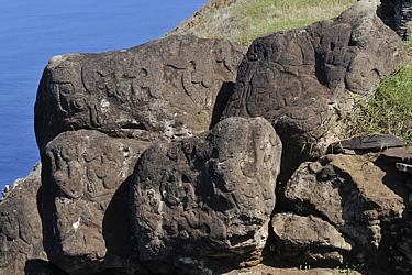 Deep down, a good bit up from the cliff, the three "Motus" - three tiny rocky islets - jut out of the surging ocean. These were once the scene of the competitions for the title of birdman - the "Tangata manu" - and all the privileges associated with it. Deep down, a good bit up from the cliff, the three "Motus" - three tiny rocky islets - jut out of the surging ocean. These were once the scene of the competitions for the title of birdman - the "Tangata manu" - and all the privileges associated with it.Every year in July, the chiefs and dignitaries of the Rapanui-Maori tribes gathered here in Orongo to send their champions into the competition to win the honor of the birdman for themselves. According to tradition, the "Hopu" - the chosen young warriors - had to overcome the 300 m steep slope down to the sea, 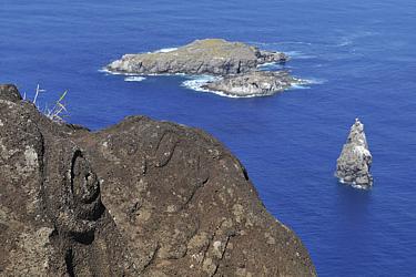 swim with the help of reed bundles to the Motu Nui, which is more than one kilometer away. From there they had to bring the very first egg of the sooty tern, witch was breeding there, back to Orongo undamaged with the help of a bastcloth attached to the head. A contest that could not only bring a lot of honor but quickly also the death, as a look into the roaring depths suggests. The chief, who sent the victorious Hopu into the race, attained the power and dignity of a birdman for one year and thus the ritual leadership over all clans of the islanders as well as the right of his clan to collect the eggs and young birds from the offshore islets. With the Christianization of the island population in the late 19th century the birdman cult came to an end. swim with the help of reed bundles to the Motu Nui, which is more than one kilometer away. From there they had to bring the very first egg of the sooty tern, witch was breeding there, back to Orongo undamaged with the help of a bastcloth attached to the head. A contest that could not only bring a lot of honor but quickly also the death, as a look into the roaring depths suggests. The chief, who sent the victorious Hopu into the race, attained the power and dignity of a birdman for one year and thus the ritual leadership over all clans of the islanders as well as the right of his clan to collect the eggs and young birds from the offshore islets. With the Christianization of the island population in the late 19th century the birdman cult came to an end.The afternoon we spend with swimming and building sandcastles on the beach of Anakena at the other end of the island, the evening with Manuel in Hanga Roa. 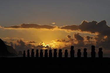 Manuel surprises us with an invitation to the local clubhouse, where young islanders are currently rehearsing the traditional dances and songs of their people. The dancers practice in T-shirts and shorts, not in the photogenic feather costumes as in the performance on the beach. Nevertheless, it is fun to watch and listen to the exotic sounds of the music. A delicious Polynesian-style meal in the "Tavake", a small restaurant in the - well, let's call it the shopping street of Hanga Roa, even if that is grossly exaggerated - rounds off another wonderful day on Rapa Nui perfectly. Manuel surprises us with an invitation to the local clubhouse, where young islanders are currently rehearsing the traditional dances and songs of their people. The dancers practice in T-shirts and shorts, not in the photogenic feather costumes as in the performance on the beach. Nevertheless, it is fun to watch and listen to the exotic sounds of the music. A delicious Polynesian-style meal in the "Tavake", a small restaurant in the - well, let's call it the shopping street of Hanga Roa, even if that is grossly exaggerated - rounds off another wonderful day on Rapa Nui perfectly.Day 7 (Ahu Tongariki, Ahu Nau Nau, Hanga Roa) Our last day on Easter Island ... Once again we struggle out of bed very early to experience the sunrise in a very special place - 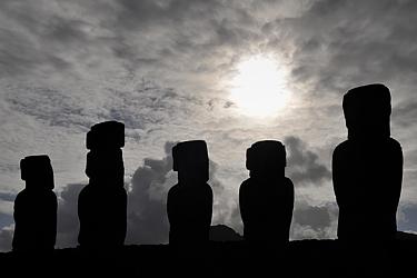 this time we have chosen the mighty Ahu Tongariki on the southeast coast of Easter Island. With the beginning of dusk we set off and reach the facility just in time to salute the 15 mo’ai in front of an impressive purple-red colored morning sky. The sunrise, which starts half an hour later, is less spectacular: A band of clouds stands low above the eastern horizon, concealing the rise of the fiery sphere from the ocean's floods. But we hardly have any reason to be dissatisfied, this time we have chosen the mighty Ahu Tongariki on the southeast coast of Easter Island. With the beginning of dusk we set off and reach the facility just in time to salute the 15 mo’ai in front of an impressive purple-red colored morning sky. The sunrise, which starts half an hour later, is less spectacular: A band of clouds stands low above the eastern horizon, concealing the rise of the fiery sphere from the ocean's floods. But we hardly have any reason to be dissatisfied,  because soon the edges of the clouds frayed by the sea breeze begin to glow in the light of the higher rising sun. Single rays of sunlight shooting through gaps in the clouds give the heads of the mo'ai veritable coronas. Finally, Sol shows himself in all its splendor above the clouds directly behind the cult site and lets the mo'ai cast long shadows over the wide grassy area in front of the platform. Also the south-eastern slope of the Rano Raraku, which towers steeply behind us and from which we were only allowed to admire the complex from above the day before yesterday, literally shines in the gentle reddish light of the morning sun. No doubt, even this early morning excursion has paid off ! because soon the edges of the clouds frayed by the sea breeze begin to glow in the light of the higher rising sun. Single rays of sunlight shooting through gaps in the clouds give the heads of the mo'ai veritable coronas. Finally, Sol shows himself in all its splendor above the clouds directly behind the cult site and lets the mo'ai cast long shadows over the wide grassy area in front of the platform. Also the south-eastern slope of the Rano Raraku, which towers steeply behind us and from which we were only allowed to admire the complex from above the day before yesterday, literally shines in the gentle reddish light of the morning sun. No doubt, even this early morning excursion has paid off !For the way back we choose the inland route, which is a little longer, but gives us the opportunity to make a last short visit to the beach of Anakena and the Ahu Nau Nau. 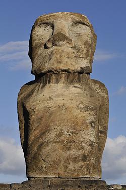 After breakfast in Hanga Roa, a stroll through the small handicraft market in the center of the town is on the agenda to get some souvenirs and gifts for the loved ones at home. At some of the stalls set up here, artisans offer a considerable selection of their products: There are moai made of wood or tufa in all conceivable sizes, jewelry with petroglyphs or motifs of the birdman cult, wooden masks and other carvings, toys made of tin, printed T-shirts and colorful Polynesian shirts, postcards, pictures and much more. We negotiate some smaller wooden cult figures and a slightly larger mo'ai made of tuff (which increases the size of our already considerable luggage in a worrying way), additionally a couple of After breakfast in Hanga Roa, a stroll through the small handicraft market in the center of the town is on the agenda to get some souvenirs and gifts for the loved ones at home. At some of the stalls set up here, artisans offer a considerable selection of their products: There are moai made of wood or tufa in all conceivable sizes, jewelry with petroglyphs or motifs of the birdman cult, wooden masks and other carvings, toys made of tin, printed T-shirts and colorful Polynesian shirts, postcards, pictures and much more. We negotiate some smaller wooden cult figures and a slightly larger mo'ai made of tuff (which increases the size of our already considerable luggage in a worrying way), additionally a couple of 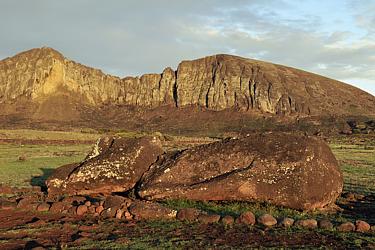 Manuel willingly offers to send the music to us by e-mail, but my very limited mailbox would hardly be enough for that. Finally, I come up with the idea of plugging my camera into the PC and - hurray, it works - filling the memory card with the exotic pieces of music that we've heard so many times over the past few days. The early evening we spend again in the "Tavake". After that, it is high time to pack our belongings and prepare for the onward journey. Tomorrow early in the morning Manuel will take us to the airport. Then it is time to say goodbye to the lonely island in the middle of the huge Pacific Ocean, which a long, long time ago has become the navel of the world for its inhabitants - and now a little for us too. It is difficult for us to say goodbye to the island with its fantastic sights and friendly people, but we also look forward to all the adventures that four more weeks ahead promise in distant South America - four weeks full of excitement and experiences on our long long journey along the Pan-Americana, which shall take us from the "navel of the world" to the "end of the world" at the southern tip of Tierra del Fuego ... Manuel willingly offers to send the music to us by e-mail, but my very limited mailbox would hardly be enough for that. Finally, I come up with the idea of plugging my camera into the PC and - hurray, it works - filling the memory card with the exotic pieces of music that we've heard so many times over the past few days. The early evening we spend again in the "Tavake". After that, it is high time to pack our belongings and prepare for the onward journey. Tomorrow early in the morning Manuel will take us to the airport. Then it is time to say goodbye to the lonely island in the middle of the huge Pacific Ocean, which a long, long time ago has become the navel of the world for its inhabitants - and now a little for us too. It is difficult for us to say goodbye to the island with its fantastic sights and friendly people, but we also look forward to all the adventures that four more weeks ahead promise in distant South America - four weeks full of excitement and experiences on our long long journey along the Pan-Americana, which shall take us from the "navel of the world" to the "end of the world" at the southern tip of Tierra del Fuego ...
Report: Heiko Otto Translation: Heiko Otto
March 2011 March 2021 |
||||||||||||||||||
|
||||||||||||||||||
| Index | |